
Spring Mnweni

The route
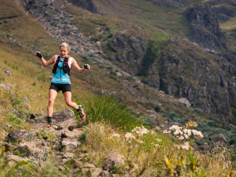
The route starts at the Mnweni cultural centre and winds its way into the berg alongside the Mnweni river. There is a well trodden path that is used by the local inhabitants to get to their huts and to travel up the Mnweni pass into Lesotho. This trail often consists of multiple parallel trails but generally makes its way up the Mnweni valley, sticking on the left hand bank up to the Shepherd’s cave area. In two sections, the path gains height above the river but in both instances the river section thus skirted contains some of the most impressive pools to be found in the berg and it is worthwile to divert to see these.
After about 15 Km the trail crosses the Mnweni river for the first time and a kilometre later takes you past Shepherd’s cave, a popular overnight spot for hikers. At this point you have climbed from 1200 m at the start up to 1650 m asl at the cave and one is in the remote upper reaches of the Mnweni valley. The trail continues for another five kilometres up the river valley, often crossing the river to the base of the Mnweni pass at around 2000 m asl in the Mnweni cutback. Over the next 2.5 km up the pass you climb almost 1000 m to the summit plateau. There is a roughly level section for two klometres across the top where the Orange river is crossed virtually at it’s source. The descent is via the aptly named Rockeries pass that takes you past the spires of the Rockeries and the imposing saddle on the other side for a six kilommetre bone jarring descent before the route levels out more for the last faster ten kilometres through the lower reaches of the little berg back to the start point, descending down the Ntonyelana river valley.
Race history
The Mnweni marathon was born in the midwinter of 2000 when trail-running legend Bruce Arnett and friend Mark Tannian pioneered the original route of this race, starting their hike in clear sunny weather from Isandhlwana Police Station and ending, about 50 kilometres and a raging blizzard later, at Club Maluti.
The allure of the challenge grew, and the first running of the point-to-point route as a race took place in January 2001. 11 runners took part in what was to all intents and purposes a gathering of friends who had set themselves to conquer the route. In 2002 the route was changed to today’s circular and less extreme format due to the logistical difficulties associated with a linear race that spanned such extreme terrain.
Over the years, entries have grown, largely by word of mouth, but recently through listings on internet and other trail running schedules, from about 30 in 2006 to around 70 in 2010 to the event being fully subscribed with the 100 runner limit being reached in 2012 , many of them now on an “annual pilgrimage”, and confirmed members of the Mnweni family.
FURTHER INFORMATION
This is a mountain trail run, with all the terrain and weather implications that the term implies
Only the first and last 5km of the route are jeep track and accessible by vehicle
The remainder of the route is single track, or no track
You are advised to be prepared for extremes of heat and cold, the possibility of fog and rain, and the eventuality of being benighted on the route
This 38 Km run involves ascending from 1200 m asl to 3000 m on the berg summit in Lesotho, a total climb of 1800 m.
It is a circular route which starts and ends at the Mnweni cultural centre (roughly at the confluence of the Mnweni and Ntonyelane rivers)in the northern Kwa Zulu Natal Drakensberg
The route follows the Mnweni Valley, ascends the Mnweni pass, crosses the source of the Orange on the plateau and returns down Rockeries pass and the Ntonyelane Valley
The route is not marked and has to be self navigated
Some straightforward route finding is required although there is a path most of the way
There is NO access for seconds and NO refreshment or water stations and you must carry your own water and energy food
The mountain water is clean and suitable to drink untreated, however it is probably best not to take water from the rivers running through inhabited areas (encountered in the first and last 5 Km of the run)
You will run through pristine wilderness. People who follow you will want to do the same. Please treat the area with respect and make sure that you do not drop litter, or cause any harm to the environment you are enjoying. Help by picking up any litter you may see on the trail.
You will receive a copy of a 1:50 000 map of the area marked with the route
A short route briefing will be held at 20:30 on the Friday evening before the race
The start time is 6 am, and the cut-off for official finishers is at 18h00 hours. If you have not begun the ascent of the Mnweni pass by 11h00, you will be turned back and accompanied to the start by a marshal.
Most people take between 6 and 12 hours to complete this run
The route is ideally suited to adventure racers, trail runners, and strong hikers
The route is NOT suited to people who are unfamiliar with rugged single-track trail running conditions
Novice trail runners with no navigational ability are advised to pair or team up with a navigator, beforehand or on the day
Please note that this is NOT a Comrades qualifying event